Realistic Atmosphere
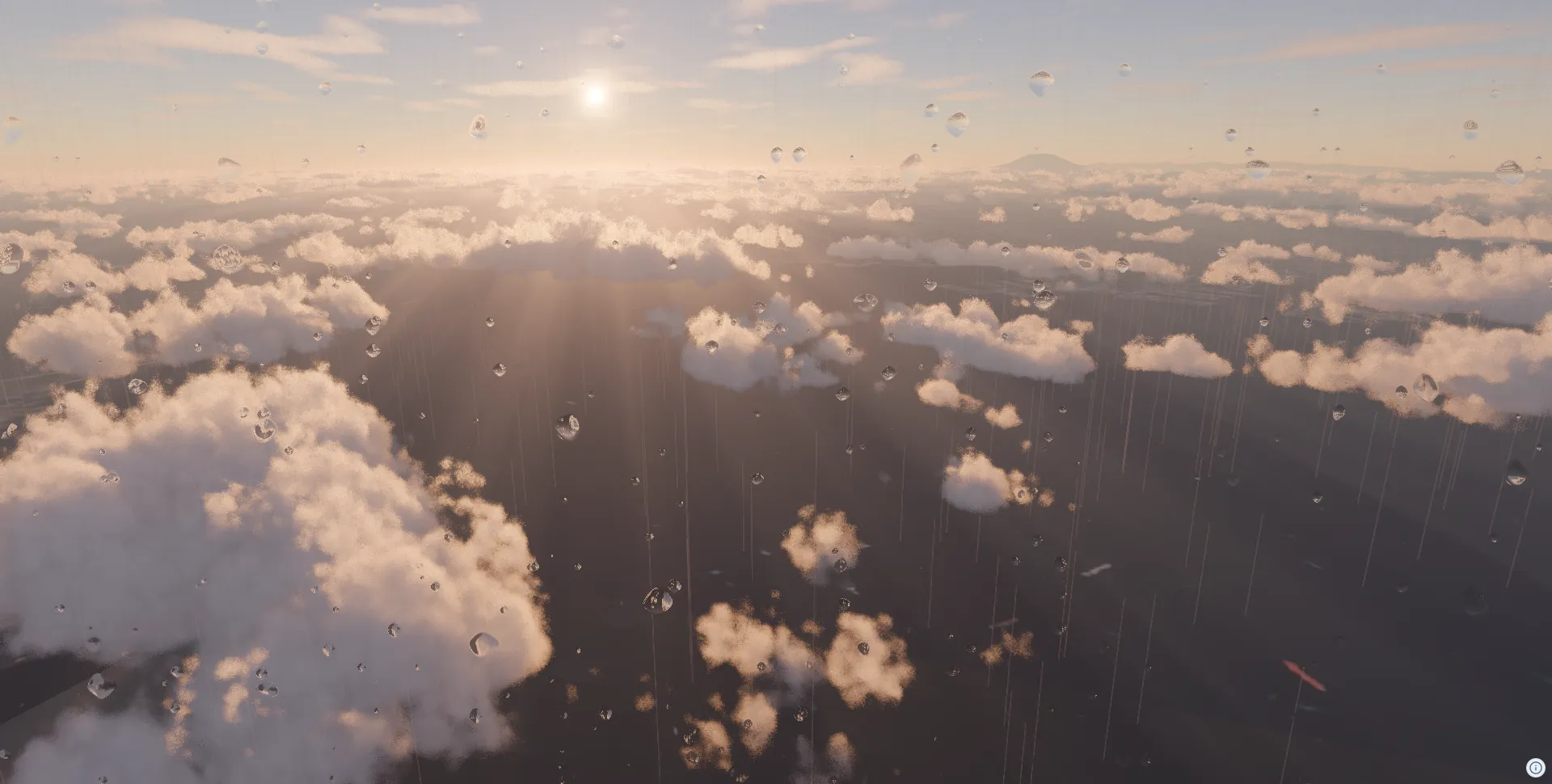
What you will learn in this tutorial:
- Adding Aerial Perspective effects
- Configuring sky, sun, and star descriptors
- Adding cloud effects
- Setting up tone mapping
- Adding rain and snow effects
- Rendering water surfaces from the terrain water mask
This tutorial builds on the project from Getting Started.
In addition, this tutorial imports Descriptor types such as CloudsEffectDesc and RainMeshDesc from @navaramap/three-default-descs.
npm install @navaramap/three-default-descsyarn add @navaramap/three-default-descspnpm add @navaramap/three-default-descsAdding the Aerial Perspective Effect
Section titled “Adding the Aerial Perspective Effect”Aerial Perspective applies a haze and atmospheric depth effect based on distance. Once DefaultPlugin is registered, addDefaultPhotorealScene() builds the whole photorealistic scene in one call. That covers the sky, sunlight, stars, skylight probe, atmospheric effects, tone mapping, and anti-aliasing.
import ThreeView from "@navaramap/three";import { DefaultPlugin, type DefaultDescriptions } from "@navaramap/three-default-plugin";
const plugin = new DefaultPlugin();const view = new ThreeView<DefaultDescriptions>({ shadow: true });view.addPlugin(plugin);await view.init();
const layers = plugin.addDefaultPhotorealScene({  deferredLighting: true,  shadow: true,  specular: true,});
const photoSource = view.addSource({  // Credit:  // - Geospatial Information Authority of Japan Tiles - Latest Nationwide Photo (Seamless)  //   https://maps.gsi.go.jp/development/ichiran.html  type: "raster-tile",  url: "https://cyberjapandata.gsi.go.jp/xyz/seamlessphoto/{z}/{x}/{y}.jpg",  maxZoom: 18,});view.addLayer({  type: "raster",  source: photoSource,});
const terrainSource = view.addSource({  type: "quantized-mesh",  url: "https://terrain.reearth.land/cesium-mesh/ellipsoid/{z}/{x}/{y}.terrain",  requestVertexNormals: true,  requestWaterMask: true,  maxZoom: 18,});view.addLayer({  type: "terrain",  source: terrainSource,  terrain: {    castShadow: true,    receiveShadow: true,  },});
// A morning sun rakes the clouds from the side, so they read as volumes rather// than flat white patches.view.atmosphere.date = new Date("2026-06-22T08:00:00+09:00");
// Above the cloud tops: the whole cloud field is laid out over the city.view.setCamera({ lng: 139.7511, lat: 35.6736, height: 4200, heading: -100, pitch: -22, roll: 0 });
Enable shadows on the sunlight:
layers.sun.update({ sun: { castShadow: true } });shadow: true in addDefaultPhotorealScene applies these shadows in the deferred lighting, and specular: true adds the sun’s highlight on reflective materials. The shadows in this tutorial’s screenshots are cloud shadows.
Setting Up Tone Mapping
Section titled “Setting Up Tone Mapping”Configure tone mapping’s exposure for a natural HDR look. This scene is lit by the atmosphere through irradiance, which comes out brighter than a forward-lit scene, so it settles around 6 where a normally lit scene sits nearer 10.
view.toneMappingExposure = 6;Adding Cloud Effects
Section titled “Adding Cloud Effects”qualityPreset: "high" sharpens the cloud detail and lightShafts: true adds god rays through the layer. Adjust shadows and density from there.
const clouds = view.addEffect<CloudsEffectDesc>({  clouds: {    qualityPreset: "high",    lightShafts: true,  },});
clouds.update({ clouds: { shadows: true } });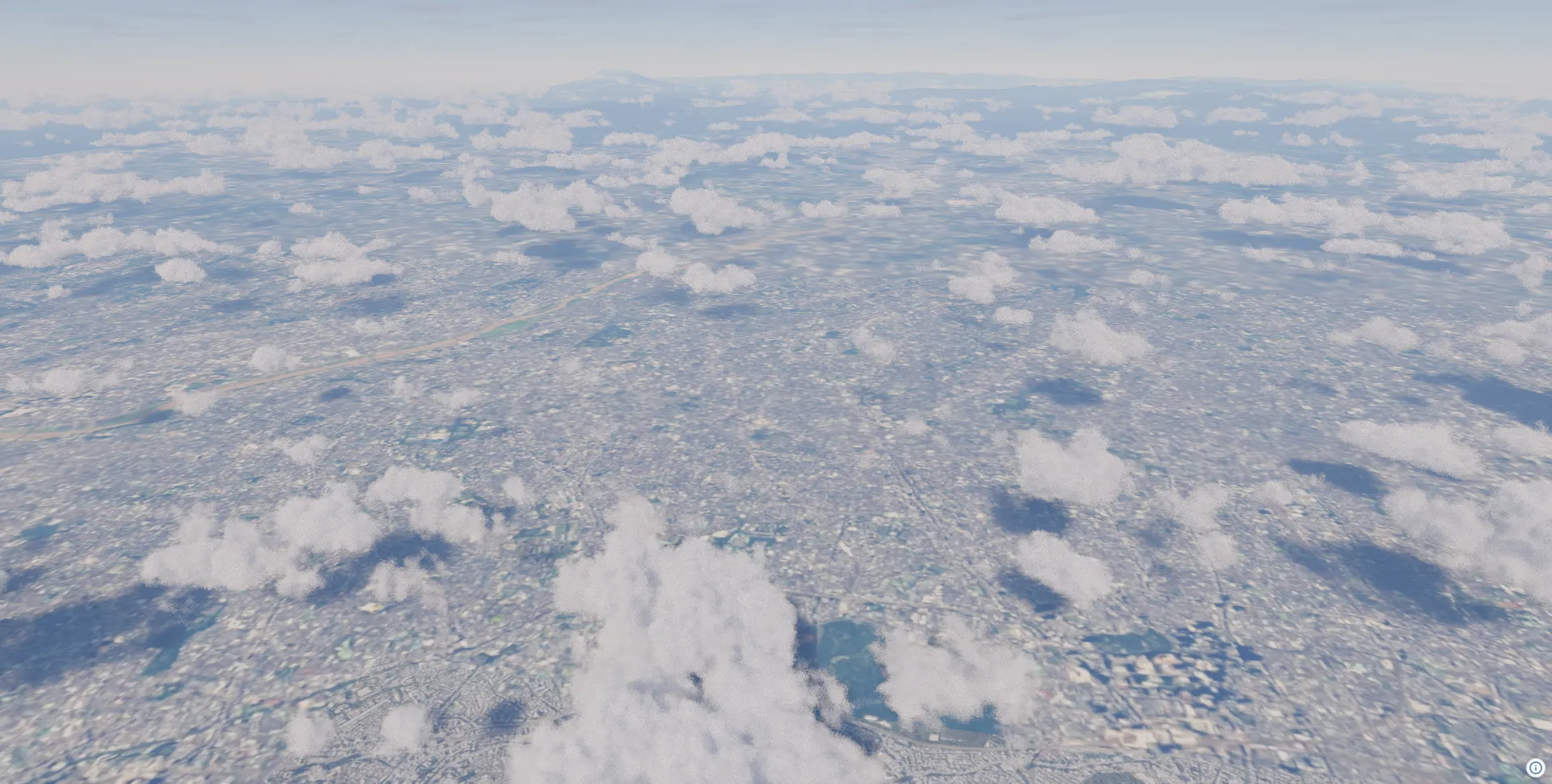
Adding Rain Effects
Section titled “Adding Rain Effects”Rain effects use a combination of two objects. RainMeshDesc renders 3D raindrop particles in the scene, and RainDropEffectDesc provides a post-processing effect of water droplets on the screen.
3D Raindrop Particles
Section titled “3D Raindrop Particles”// Enable the animation loop to keep rain animation runningview.animation = true;
const rain = view.addMesh<RainMeshDesc>({ rain: { particleCount: 5000, speed: 0.0015, opacity: 1.0, width: 3, // m height: 60.0, // m areaWidth: 500, // m areaHeight: 1000, // m maxHeight: 10000, // m. See the note under the snow section },});
view.setCamera({ lng: 139.7511, lat: 35.6736, height: 700, heading: -100, pitch: 3, roll: 0 });Screen Water Droplet Effect
Section titled “Screen Water Droplet Effect”dropSizeFactor and dropGridSize set the frequency of the droplet grid, not the droplet radius, so lower values give bigger drops. Raise dropDensity to keep the screen from looking empty once the drops are large.
const rainDropEffect = view.addEffect<RainDropEffectDesc>({ rainDrop: { opacity: 0.8, dropGridSize: 12, dropDensity: 0.7, dropSizeFactor: 0.018, },});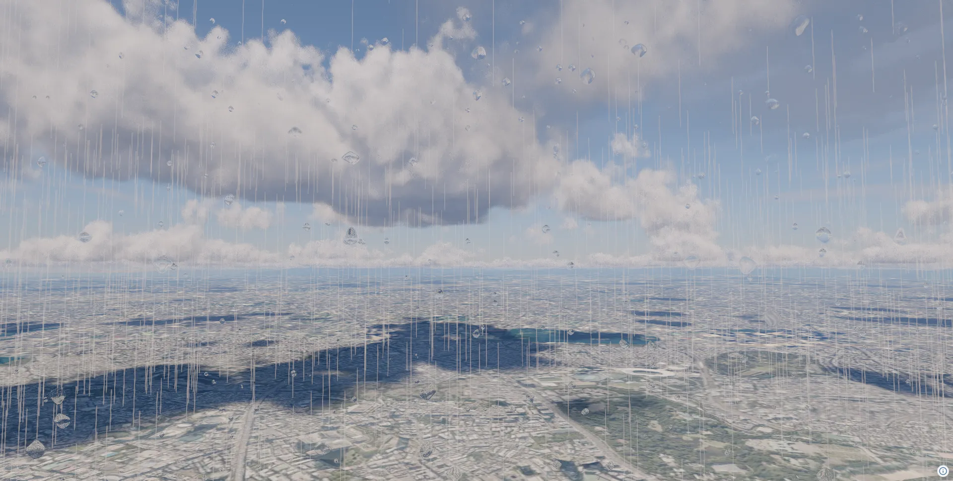
Adding Snow Effects
Section titled “Adding Snow Effects”Remove the rain object and add SnowMeshDesc instead.
const snow = view.addMesh<SnowMeshDesc>({ snow: { particleCount: 10000, speed: 0.00005, size: 20, opacity: 1, areaWidth: 400, areaHeight: 800, maxHeight: 3000, movementStrength: { x: 50, y: 20, z: 50 }, movementSpeed: { x: 0.0005, y: 0.0002, z: 0.0005 }, },});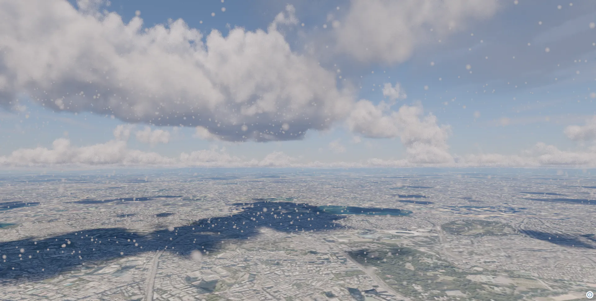
Adding Water Surfaces (Terrain Water Mask)
Section titled “Adding Water Surfaces (Terrain Water Mask)”Cesium quantized-mesh tiles can carry a water mask next to the mesh. Request it with requestWaterMask: true on the source and Navara shades the masked pixels as water. The result is a reflective, low-roughness surface that catches the sun glint and picks up environment and SSR reflections. No extra source or layer is needed.
const terrainSource = view.addSource({  type: "quantized-mesh",  url: "https://terrain.reearth.land/cesium-mesh/ellipsoid/{z}/{x}/{y}.terrain",  requestVertexNormals: true,  requestWaterMask: true,  maxZoom: 18,});view.addLayer({  type: "terrain",  source: terrainSource,  terrain: { castShadow: true, receiveShadow: true },});
view.atmosphere.date = new Date("2026-01-01T16:15:00+09:00");view.toneMappingExposure = 12;
view.setCamera({ lng: 139.88, lat: 35.42, height: 2800, heading: 250, pitch: -16, roll: 0 });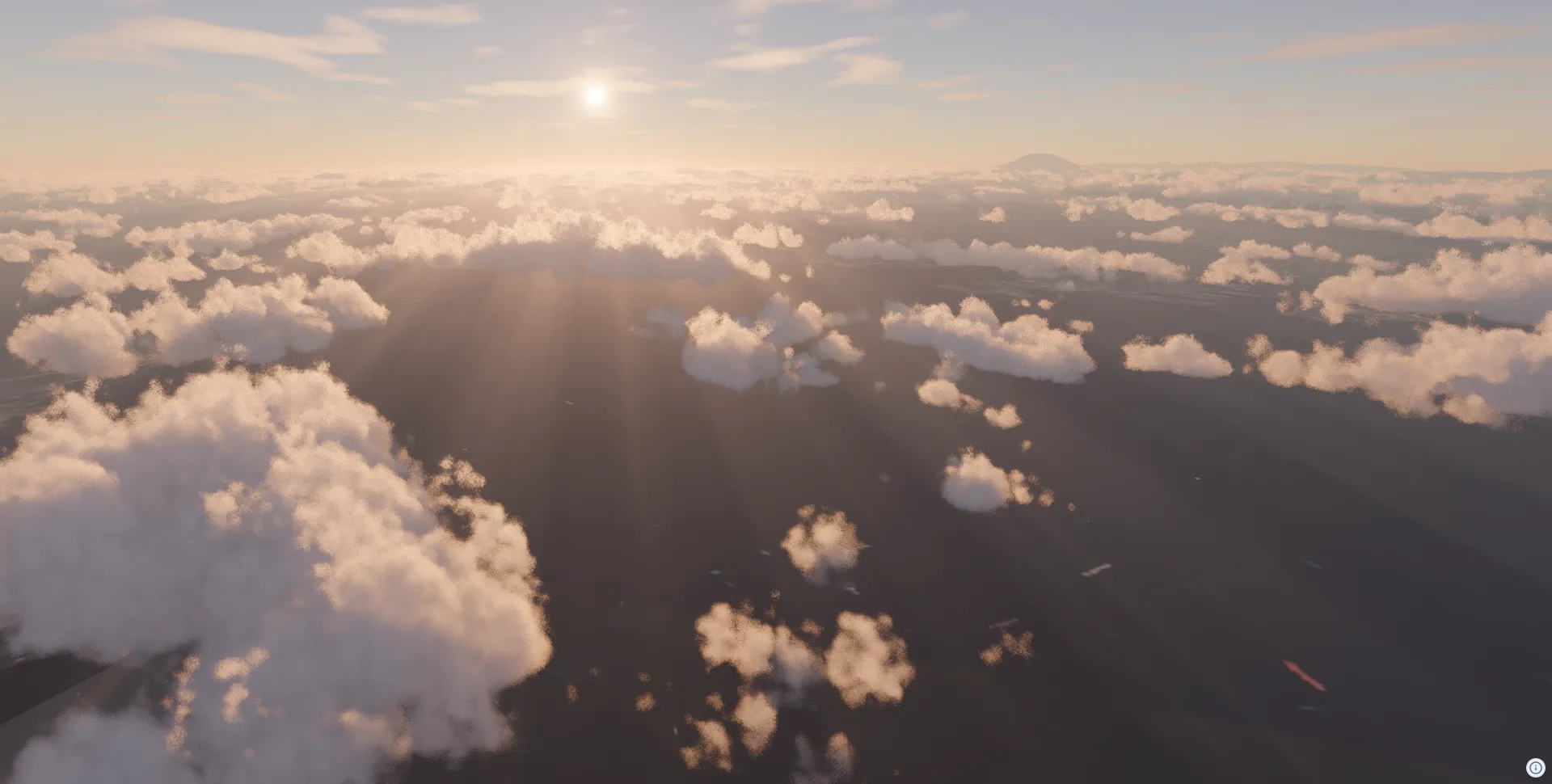
Combining with SSR (Screen Space Reflections)
Section titled “Combining with SSR (Screen Space Reflections)”Adding SSREffectDesc enables real-time reflections of buildings and other objects on the water surface.
const plateauSource = view.addSource({  // Credit:  // - 3D City Model (Project PLATEAU) Chuo Ward (FY2023) - MLIT PLATEAU  //   https://www.geospatial.jp/ckan/dataset/plateau-13102-chuo-ku-2023  type: "3d-tiles",  url: "https://assets.cms.plateau.reearth.io/assets/4c/f2436a-e2be-40e2-83da-f1781f36e30b/13102_chuo-ku_pref_2023_citygml_1_op_bldg_3dtiles_13102_chuo-ku_lod2_no_texture/tileset.json",});view.addLayer({  type: "3d-tiles",  source: plateauSource,  model: {    show: true,    color: new Color().setStyle("#ffffff"),    metalness: 0,    roughness: 0.5,    castShadow: true,    receiveShadow: true,  },});
view.addEffect<SSREffectDesc>({  ssr: {},});
view.toneMappingExposure = 6;view.atmosphere.date = new Date("2026-06-22T08:00:00+09:00");
view.setCamera({  lng: 139.7868,  lat: 35.6733,  height: 68,  heading: 240,  pitch: -10,  roll: 0,});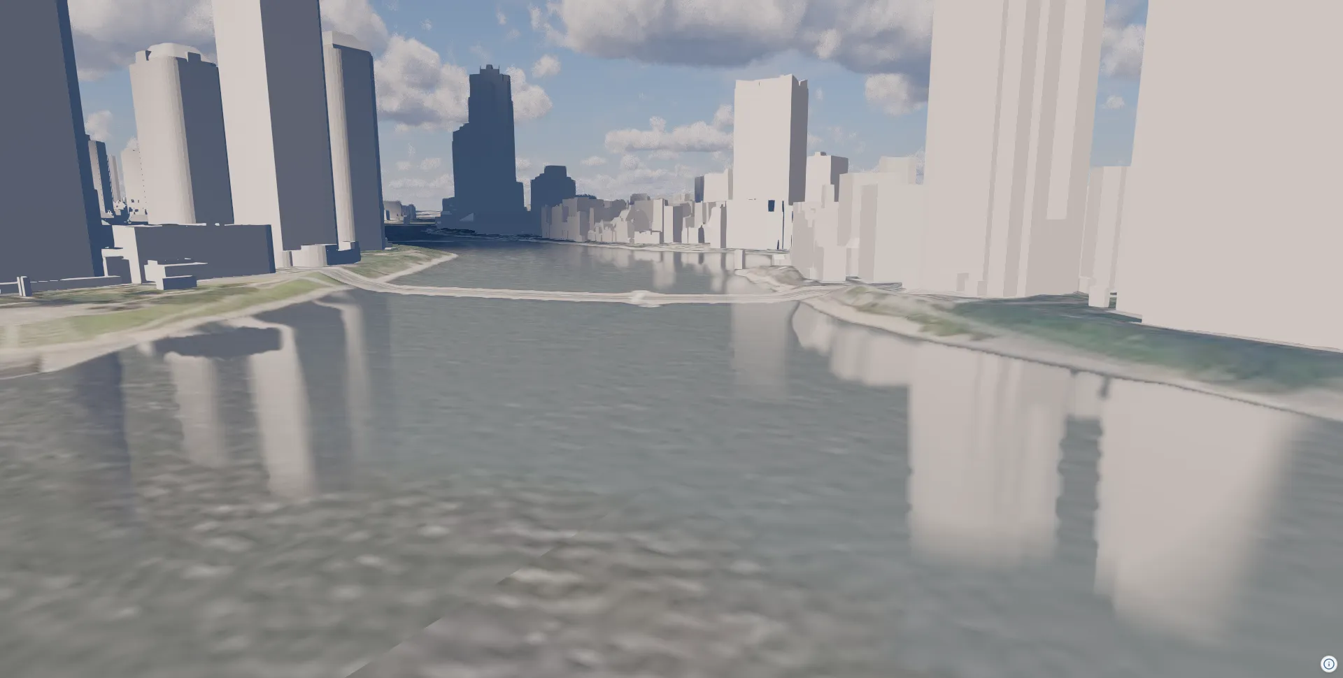
Complete Example
Section titled “Complete Example”import ThreeView, { Color } from "@navaramap/three";import { type CloudsEffectDesc, type RainDropEffectDesc, type RainMeshDesc, type SnowMeshDesc, type SSREffectDesc, ToneMappingMode } from "@navaramap/three-default-descs";import { DefaultPlugin, type DefaultDescriptions } from "@navaramap/three-default-plugin";
const plugin = new DefaultPlugin();const view = new ThreeView<DefaultDescriptions>({ shadow: true, animation: true,});view.addPlugin(plugin);await view.init();
const layers = plugin.addDefaultPhotorealScene({ deferredLighting: true, shadow: true, specular: true,});
const photoSource = view.addSource({ // Credit: // - Geospatial Information Authority of Japan Tiles - Latest Nationwide Photo (Seamless) // https://maps.gsi.go.jp/development/ichiran.html type: "raster-tile", url: "https://cyberjapandata.gsi.go.jp/xyz/seamlessphoto/{z}/{x}/{y}.jpg", maxZoom: 18,});view.addLayer({ type: "raster", source: photoSource,});
const terrainSource = view.addSource({ type: "quantized-mesh", url: "https://terrain.reearth.land/cesium-mesh/ellipsoid/{z}/{x}/{y}.terrain", requestVertexNormals: true, requestWaterMask: true, maxZoom: 18,});view.addLayer({ type: "terrain", source: terrainSource, terrain: { castShadow: true, receiveShadow: true, },});
layers.sun.update({ sun: { castShadow: true } });
layers.toneMapping.update({ toneMapping: { mode: ToneMappingMode.AGX } });view.toneMappingExposure = 6;
const clouds = view.addEffect<CloudsEffectDesc>({ clouds: { qualityPreset: "high", lightShafts: true, },});
clouds.update({ clouds: { shadows: true } });
view.addMesh<RainMeshDesc>({ rain: { particleCount: 5000, speed: 0.0015, opacity: 1.0, width: 3, height: 60.0, areaWidth: 500, areaHeight: 1000, maxHeight: 10000, },});
view.addEffect<RainDropEffectDesc>({ rainDrop: { opacity: 0.8, dropGridSize: 12, dropDensity: 0.7, dropSizeFactor: 0.018, },});
const plateauSource = view.addSource({ // Credit: // - 3D City Model (Project PLATEAU) Chuo Ward (FY2023) - MLIT PLATEAU // https://www.geospatial.jp/ckan/dataset/plateau-13102-chuo-ku-2023 type: "3d-tiles", url: "https://assets.cms.plateau.reearth.io/assets/4c/f2436a-e2be-40e2-83da-f1781f36e30b/13102_chuo-ku_pref_2023_citygml_1_op_bldg_3dtiles_13102_chuo-ku_lod2_no_texture/tileset.json",});view.addLayer({ type: "3d-tiles", source: plateauSource, model: { show: true, color: new Color().setStyle("#ffffff"), metalness: 0, roughness: 0.5, castShadow: true, receiveShadow: true, },});
view.addEffect<SSREffectDesc>({ ssr: { },});
view.atmosphere.date = new Date("2026-01-01T16:15:00+09:00");view.toneMappingExposure = 12;
view.setCamera({ lng: 139.88, lat: 35.42, height: 2800, heading: 250, pitch: -16, roll: 0 });